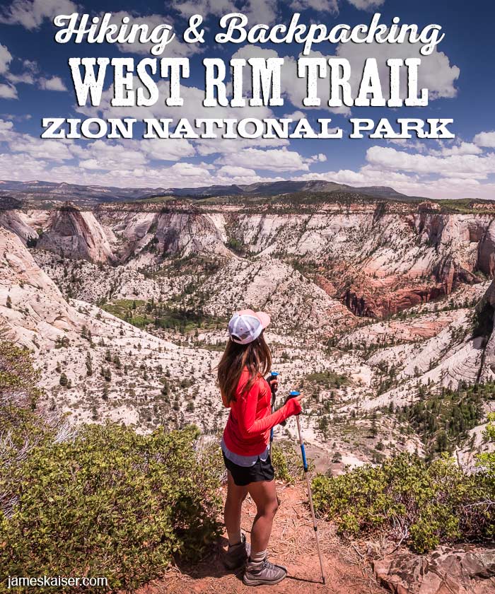
The West Rim Trail is one of the best backpacking trails in Zion National Park. The hike starts near Lava Point, one of the highest points in Zion, then gradually descends into Zion Canyon. Along the way, you’ll pass through a fantastic range of ecosystems and landscapes.
Most hikers attempt the West Rim Trail as a two-day backpack, spending the night at one of eight campsites along the 14-mile trail. (Permits are required for backpackers and campsites, see below.) Strong day hikers can complete the West Rim Trail in a single day.
West Rim Trail Facts
Rating: Strenuous
Hiking Time: 1–2 days
Distance: 14.2 miles
Elevation Change: 3,400 feet
West Rim Trail Permits
Zion National Park requires permits for all backpackers who camp along the trail. You can apply for permits on the park’s website.
Day hikers do not need permits.
Best Times to Hike and Backpack the West Rim Trail
Summer is one of the best seasons to hike the West Rim Trail. Much of the trail lies above 6,000 feet (1,800 meters), resulting in cooler temperatures than Springdale and Zion Canyon. If you’re backpacking and camping, summer has the most comfortable temperatures at night.
Spring and fall are beautiful times to hike the West Rim Trail. You’ll enjoy wildflowers in spring and gorgeous foliage in fall. The only downside is chilly temperatures at night.
In winter access to the West Rim trailhead is restricted due to snow.

Discover the best of Zion National Park

The #1 Zion guidebook.
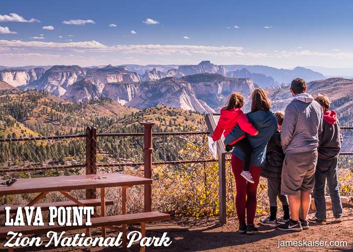
Trailhead
The West Rim Trail starts 3/4 of a mile southeast of Lava Point. Private hiking shuttles often drop hikers off at Lava Point Campground, where you can use the toilet before starting the hike. It’s also worth strolling to nearby Lava Point to enjoy the panoramic views.
From Lava Point campground follow the spur trail 0.1 miles to the dirt road, then turn right and walk 0.7 miles to the trailhead. You’ll soon reach a junction with the Wildcat Trail. Continue straight (south) across Horse Pasture Plateau.
West Rim Trailhead Shuttles
Private shuttles are one of the best and easiest ways to reach the West Rim trailhead. I list the best private shuttle companies in my guidebook Zion National Park: The Complete Guide.

Trail Description
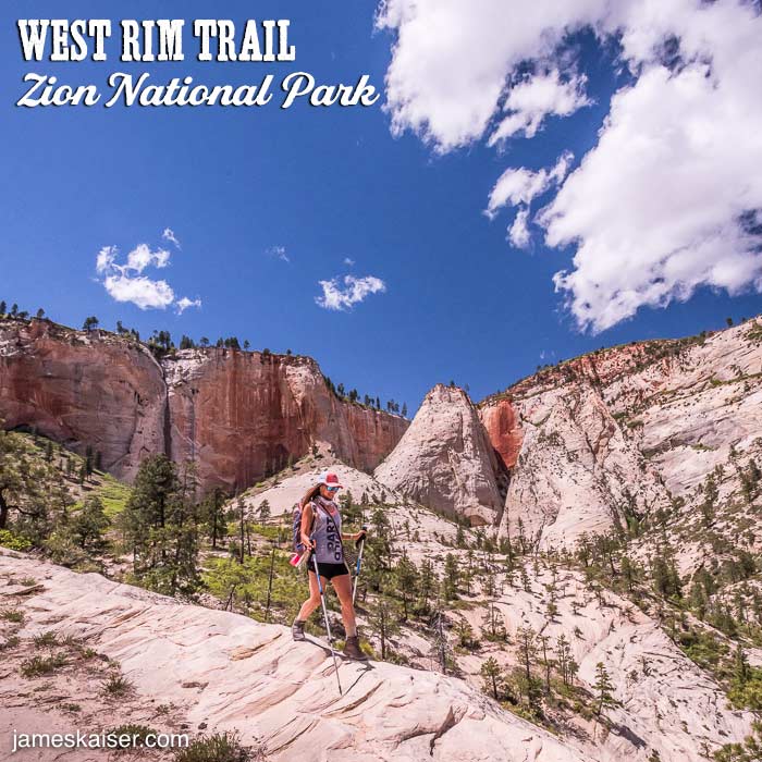
The West Rim Trail starts among tall ponderosa pines and quaking aspen near Lava Point, then drops into a piñon-juniper forest with scattered views of West Zion’s dramatic peaks. With each passing mile, the views get better and better.
Sawmill Spring Junction (1 Mile)
A spur trail leads to the first of three dependable springs on the West Rim Trail. The Zion wilderness desk posts which springs are currently flowing.
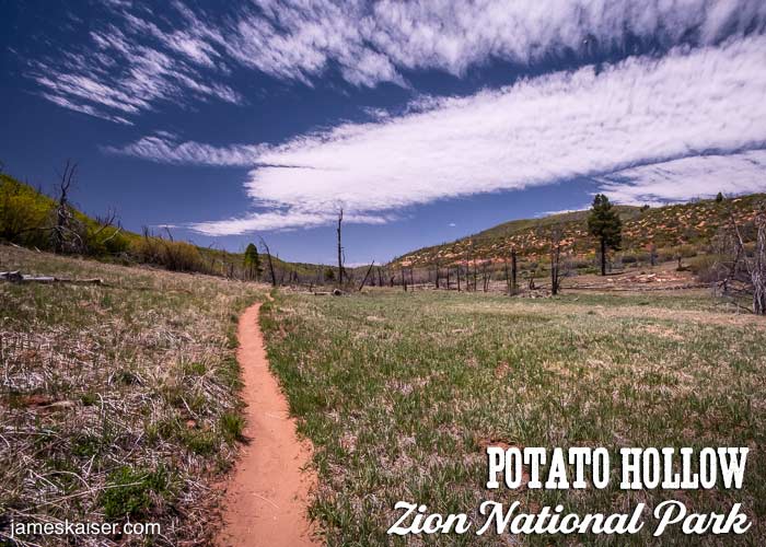
Potato Hollow Spring (5.2 Miles)
After passing a series of pretty meadows along Horse Pasture Plateau, you’ll reach a signed junction for Potato Hollow Spring. This is the last dependable water source before Cabin Spring. Backpackers should replenish their water here. Potato Hollow Spring is located off the spur trail to campsite 8.
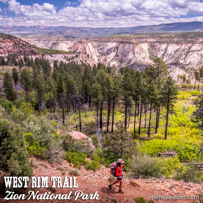
Telephone Canyon Junction (6.8 Miles)
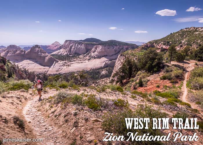
After dipping up and down and passing several lovely viewpoints, the trail heads uphill to the West Rim. Before reaching the rim, the Telephone Canyon Trail veers left, offering a 1.8-mile shortcut to West (Cabin) Spring. Continue right along the scenic West Rim Trail, where campsites 2–6 are located.
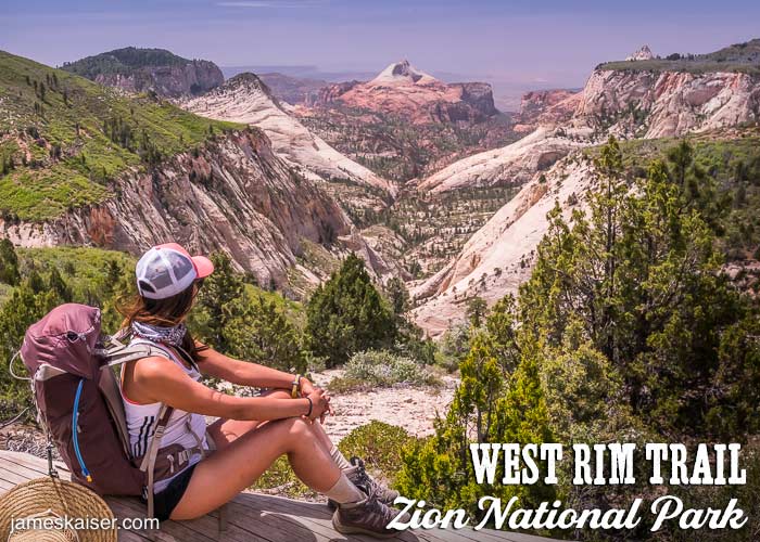
As the trail skirts the rim of the plateau, you’ll be treated to gorgeous views of dramatic sandstone peaks. Eventually, the trail begins its descent towards Telephone Canyon.
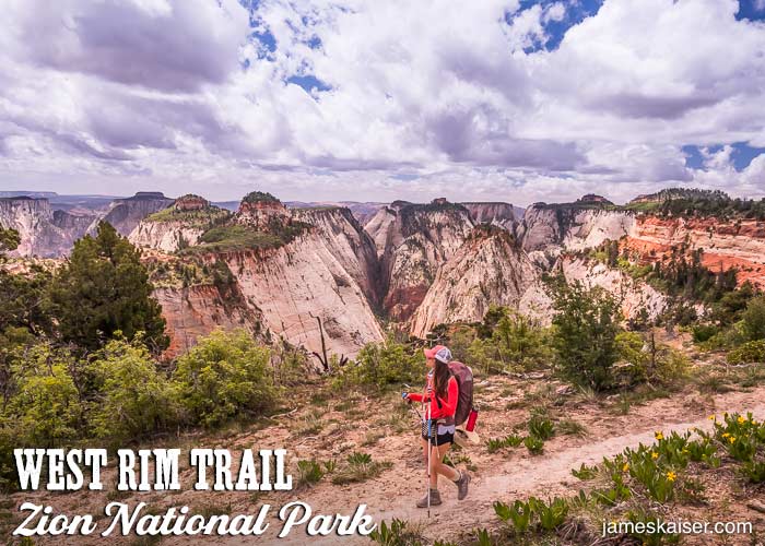
West (Cabin) Spring (9.8 Miles)
Towards the end of the plateau, the trail descends into a grove of tall ponderosa pines. Near the southern junction with the Telephone Canyon Trail, a spur trail heads to West (Cabin) Spring. After replenishing your water supply, continue along the spur trail to an exposed lookout with stunning views.

Back on the trail, you’ll descend the steep walls of Behunin Canyon, then curve around the base of Mount Majestic. Waves of bleached sandstone roll across the landscape. This is one of my favorite places in Zion. Eventually, the trail ascends the eastern edge of Refrigerator Canyon where cairns (small rock piles) mark the sometimes faint trail.
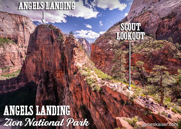
Scout Lookout (12.4 Miles)
The West Rim Trail officially ends at Scout Lookout, where crowds line up for the final push to Angels Landing.
The Grotto (14.2 Miles)
From The Grotto Shuttle Stop (#6) catch Zion’s free shuttle back to civilization.
Discover the best of Zion National Park
The #1 Zion guidebook.