
Observation Point is situated 2,000 feet above the northern end of Zion Canyon, offering panoramic views of Zion National Park. As you gaze down the full length of Zion Canyon, dozens of fabulous peaks cascade towards the horizon.
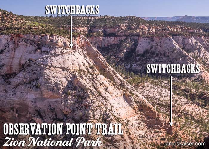
The most challenging and scenic route to Observation Point is a four-mile, one-way hike that starts at Weeping Rock (shuttle stop #7) on the floor of Zion Canyon. As you ascend the trail, you’ll pass through Echo Canyon (a dramatic, shadowy slot canyon), then climb a series of exposed switchbacks to the rim.
At times, the dropoffs on the switchbacks are dramatic. But the trail is wide enough that even those with a fear of heights should feel comfortable. Once at the rim, it’s an easy 0.8-mile stroll to the viewpoint, which sits on a rocky outcrop filled with juniper trees and piñon pines.
*Alternate Route
A second, significantly easier route to Observation Point starts at the East Mesa trailhead. (See “Observation Point Alternate Route” below.)
Observation Point Trail Facts
Rating: Strenuous
Hiking Time: 4–5 hours
Distance: 8 miles, round-trip
Elevation Change: 2,150 feet
Best Times to Hike the Observation Point Trail
Spring and Fall are the best seasons to hike Observation Point. In summer the trail can be crowded (though not nearly as crowded as Angels Landing). In winter the trail can be icy and dangerous.
Observation Point Trailhead
The Observation Point Trail starts at Weeping Rock Shuttle Stop #7.
Trail Description
From the Weeping Rock Shuttle Stop, cross a small footbridge and follow the signs to Observation Point. A series of steep switchbacks zigzag up the steep canyon walls. Weeping Rock is visible to the north, while The Great White Throne rises over 2,000 feet to the south.
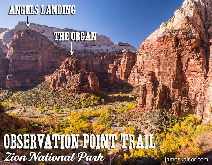
After 0.7 miles you’ll reach the junction with the Hidden Canyon Trail. Bear left and continue your ascent. Glorious views of Angels Landing and The Organ unfold below. In late October/early November, brilliant foliage lights up Zion Canyon. Eventually, after rounding a sharp corner, the trail flattens out en route to Echo Canyon.
Echo Canyon (1.5 Miles)
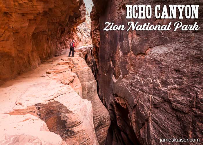
This narrow canyon, located roughly 1,000 feet above the floor of Zion Canyon, is one of the most interesting destinations en route to Observation Point. Cool, shady and filled with fabulous geology, Echo Canyon is a great place to take a break. After exiting the narrow slot canyon, over 1,000 feet of vertical elevation change awaits.
East Rim Trail Junction (2.1 Miles)
At just over two miles you’ll reach the junction with the East Rim Trail—one of the most popular backpacking trails in Zion. The East Rim Trail rises to the east rim of Zion Canyon, providing easy access to Cable Mountain and Deertrap Mountain, before dropping into East Zion.
The East Rim Trail Junction marks the halfway point to Observation Point. Bear left at the junction to begin the final ascent. Much of this section consists of steep switchbacks blasted into Navajo Sandstone. Spectacular views unfold in all directions the higher you climb.
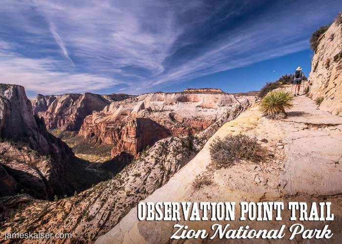
Warning: Watch your step! In places, the edge of the trail has thousand-foot dropoffs. Keep away from the edge and exercise caution while hiking.
East Mesa Trail Junction (3.6 Miles)
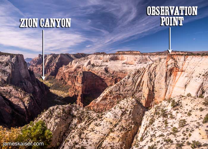
The hardest part of the Observation Point Trail—the 2,000-foot vertical ascent—is now behind you. From the East Mesa Trail Junction, it’s an easy stroll along the rim to Observation Point. As you approach the overlook, you’ll enjoy dramatic views of Zion Canyon below.
Observation Point (4 Miles)
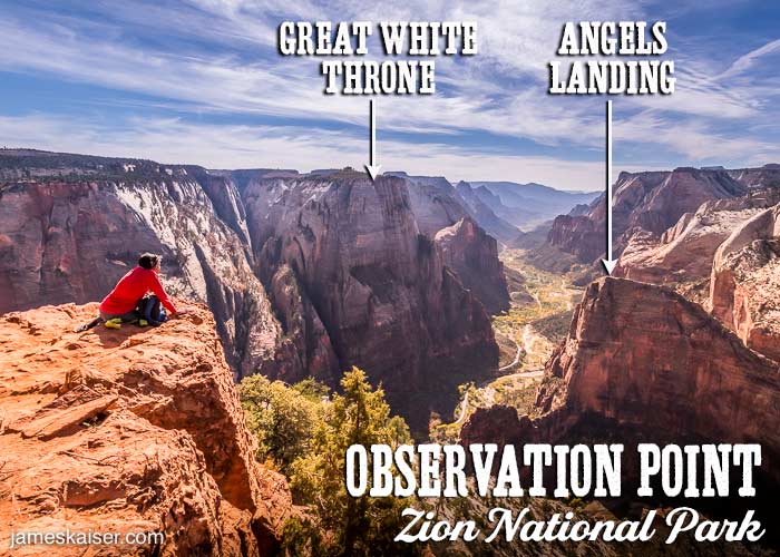
After hiking along the rim, you’ll drop into a piñon pine-juniper grove that covers much of Observation Point. The southern tip of Observation Point offers incomparable views of Zion Canyon. Spread out below are Angels Landing, The Great White Throne, Lady Mountain, and other dramatic peaks. Twisting along the bottom of the canyon is the Virgin River, which carved this incredible landscape over millions of years.
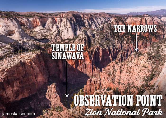
Most hikers gather at Observation Point’s famous southern tip. But there are some great, uncrowded viewpoints to the northwest. As you hike back from the tip, veer left to explore these “secret” viewpoints. The dramatic views to the northwest include the Temple of Sinawava and the start of The Narrows.
Observation Point Alternate Route: East Mesa Trail
If the splendid views from Observation Point sound intriguing—but hiking four miles and 2,000 vertical feet does not—there is an alternative. The East Mesa Trail, which starts at the park’s eastern boundary, lies 3.3 miles from Observation Point and its elevation change is just 250 feet.
While others are huffing and puffing up switchbacks, you’ll be whistling while you walk. Of course, the East Mesa Trail isn’t nearly as scenic as the Observation Point Trail. But what it lacks in scenery, it more than makes up for in ease to your knees.
Drive to the trailhead (one hour from Springdale) for an out-and-back hike, or hire a shuttle to drop you off at the trailhead, then hike down Observation Point Trail to Weeping Rock, where you can catch the free park shuttle.
Alternate Route Facts
Rating: Easy
Hiking Time: 3 hours
Distance: 6.6 miles round-trip
Elevation Change: 250 feet
East Mesa Trailhead
Drive 2.4 miles east of Zion’s East Entrance, then turn left onto North Fork County Road. Drive 5.4 miles to Ponderosa Ranch, then follow the signs to East Mesa Trailhead. High clearance is required for the final, bumpy stretch, which is sometimes compromised by mud, snow, or ice.

