
The Beehive Trail
Difficulty: Strenuous
Distance: 1.6 miles, round-trip
Hiking Time: 1–2 hours
Elevation Change: 520 feet
Short, steep, and sweet, the Beehive Trail is one of the most popular trails in Acadia National Park. Rising to the top of a beehive-shaped dome above the Park Loop Road, the trail provides unbeatable views of Sand Beach and Great Head Peninsula.
Although The Beehive is one of the shorter hikes in Acadia, it’s not for the faint of heart. There are several steep drop-offs and a few sections that require climbing iron rungs.

Trailhead
The Beehive trailhead is located across from the Sand Beach parking area, just off the Park Loop Road. Parking at Sand Beach is often a nightmare, particularly in the busy summer months. A better option is the free Island Explorer shuttle, which stops at Echo Lake on the .
Trail Description
From the trailhead, follow the Bowl Trail 0.2 miles to an intersection with the Beehive Trail. The classic route follows the Beehive Trail up the south face of The Beehive. This route has fabulous views thanks to the many steep, exposed sections. Stone steps lead to narrow ledges and a handful of sections where you’ll need to climb iron rungs drilled into the rock.
(If you’re afraid of heights, consider skipping the Beehive Trail in favor of the Bowl Trail, which wraps around the backside of the Beehive to the summit.)

Discover the best
of Acadia National Park

The bestselling Acadia guidebook for over two decades.
The final set of iron rungs tops out on a broad slab of granite with fabulous views of Sand Beach below. Take a moment to enjoy the views (or take a while to enjoy a picnic lunch), then continue along the trail as it heads into a lovely pine forest.
Eventually, you’ll come to another patch of bare granite with dramatic views to the north. Champlain Mountain rises above Frenchman Bay, with the Porcupine Islands in the distance.
The trail continues through the woods, then drops down to The Bowl, a small mountain pond nestled behind the Beehive. The Bowl is a perfect place to soak your feet or jump in for a refreshing swim.
From The Bowl, follow the Bowl Trail back to the trailhead.
The Beehive Hiking Photos
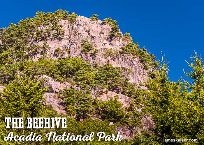
The Beehive, rising 520 feet (160 meters) above sea level. Look close and you can see hikers traversing the bare granite south face.

Junction of The Beehive Trail and The Bowl Trail. Located 0.2 miles (0.3 kms) past the trailhead. Which way will you go?
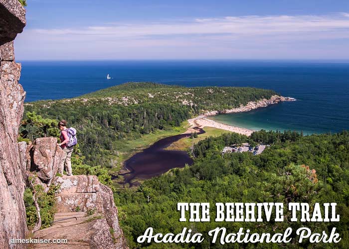
Narrow ledge on the south face of The Beehive. Downside: a steep drop. Upside: spectacular views of Sand Beach and Great Head. (Note the sailboat in the distance.)
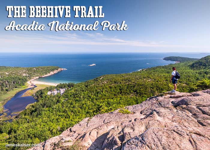
View near the summit of The Beehive. Sand Beach and Great Head to the left. Otter Cliffs to the right, with the Cranberry Isles beyond.
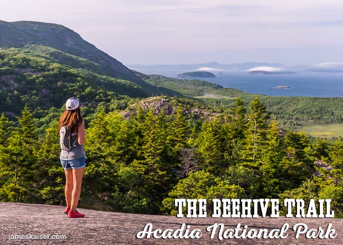
Looking north near the summit of The Beehive. Champlain Mountain rising to the left, Frenchman Bay and the Porcupine Islands to the right.
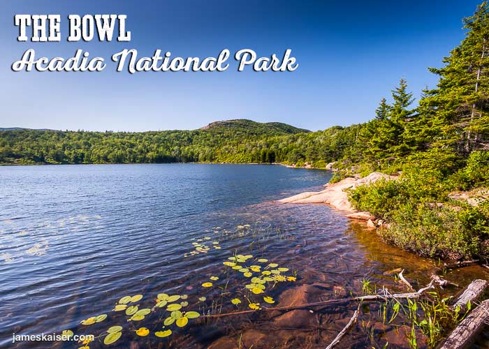
The Bowl: a pristine mountain pond near the summit of The Beehive. After a sweaty hike on a hot summer day, this is a great place to dip your feet in the water or go for a swim.
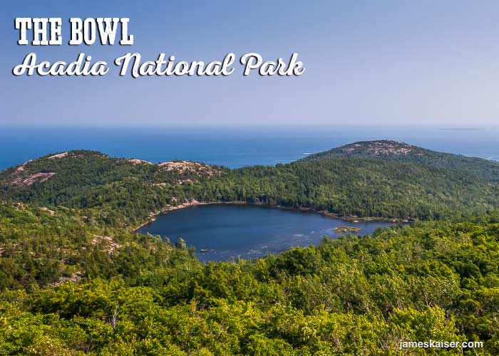
Looking down on The Bowl from above. The Beehive is to the left. Gorham Mountain is to the right. And the Gulf of Maine lies beyond.
Discover the best
of Acadia National Park
The bestselling Acadia guidebook for over two decades.